
Awards
-
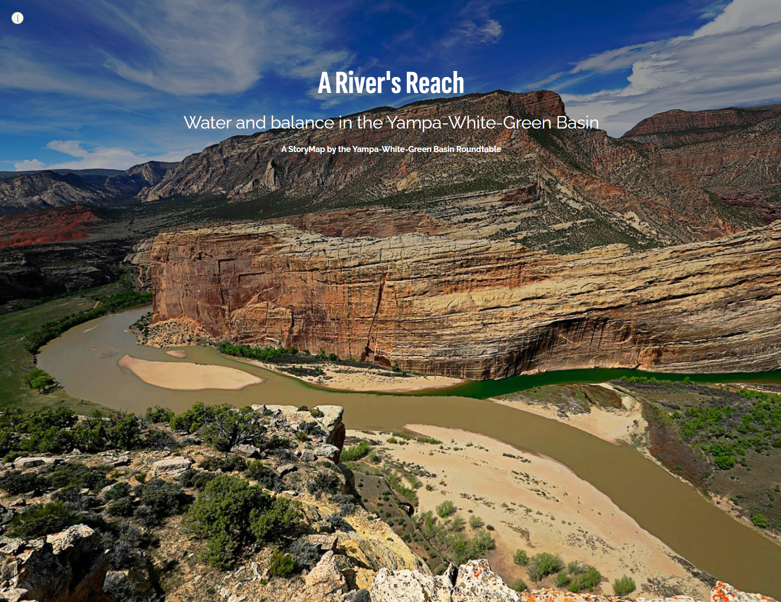
Honorable Mention, Cartography and GIS Society Map Design Competition: A River's Reach; Water and Balance in the Yampa White Green Basin
Up against some stiff competition, my StoryMap “A River's Reach” nabbed Honorable Mention in the Cartography and Geographic Information Society Map Design Competition!
"A River's Reach", created for the Yampa White Green Basin Roundtable, tells the unique and complex story of water in the Yampa White Green Basin in northwest Colorado, a region known for some of the last free-flowing rivers in the American West.
From a wild hydrology driven by snowpack and runoff to novel water rights for fish and recreation to the collaboration of seemingly disparate water users in a time of rising drought and declining flows, this StoryMap shows the care and dedication it takes to steward water in the Basin and beyond, now and into the future. -
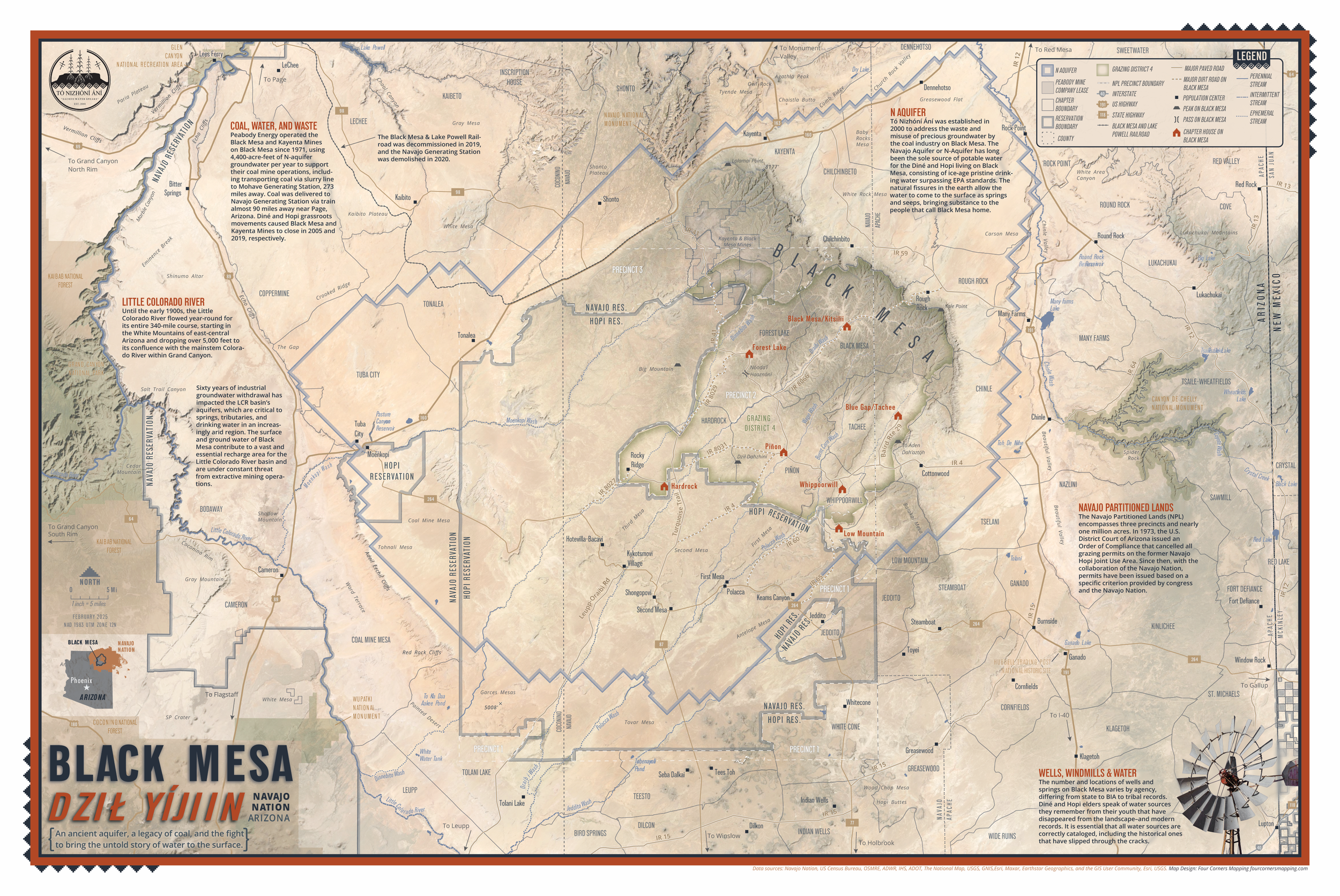
Best Layout for Print, 2025 Esri UC: Black Mesa Map (Dził Yíjiin)
This map was created in partnership with the Diné-led nonprofit Tó Nizhóní Ání, which works to protect the Navajo Aquifer—a critical, and often invisible, water source for communities in northeastern Arizona. The map blends detailed topography, satellite imagery, and finely crafted hydrologic symbology to bring this landscape to life.
-
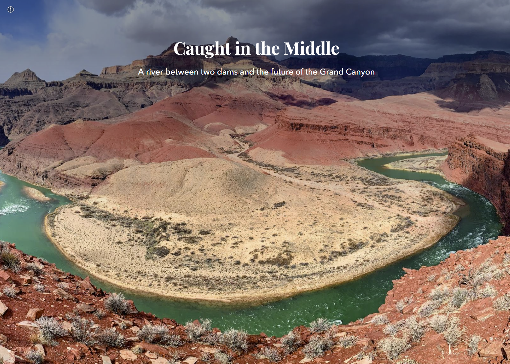
Finalist, 2023 ArcGIS StoryMaps Competition: Caught in the Middle: A River Between Two Dams and the Future of the Grand Canyon
Out of hundreds of thousands of entries worldwide, my ArcGIS StoryMap, Caught in the Middle, was selected as a finalist in the 2023 ArcGIS StoryMaps Competition for its “striking use of visuals, exceptional leveraging of product features, and exemplification of storytelling best practices”. This StoryMap was a collaboration with the client, scientists, Tribal leaders, historical experts, and agency officials to create a previously untold narrative around the increasing water risks to the Grand Canyon and Colorado River Basin.
-

First Place in the GIS Certification Institute 2024 Map Contest : Bicycle and Pedestrian Crashes
Four Corners designed all the maps for the City of Durango’s 2023 Multimodal Transportation Plan, which guides the implementation of projects to move Durango towards an integrated multimodal transportation network. My map, Bicycle and Pedestrian Crashes, aggregated crash data into a tessellated hexagonal grid, which allowed City planners to see at a glance where the highest frequency of each or both crash types occurred, identifying key intersections with frequent crashes, and showing that the main thoroughfare acts as an obstacle to multimodal traffic. This map won First Place in the GIS Certification Institute 2024 Map Contest for its “remarkable skill, innovation, and dedication to the craft of cartography”.
-
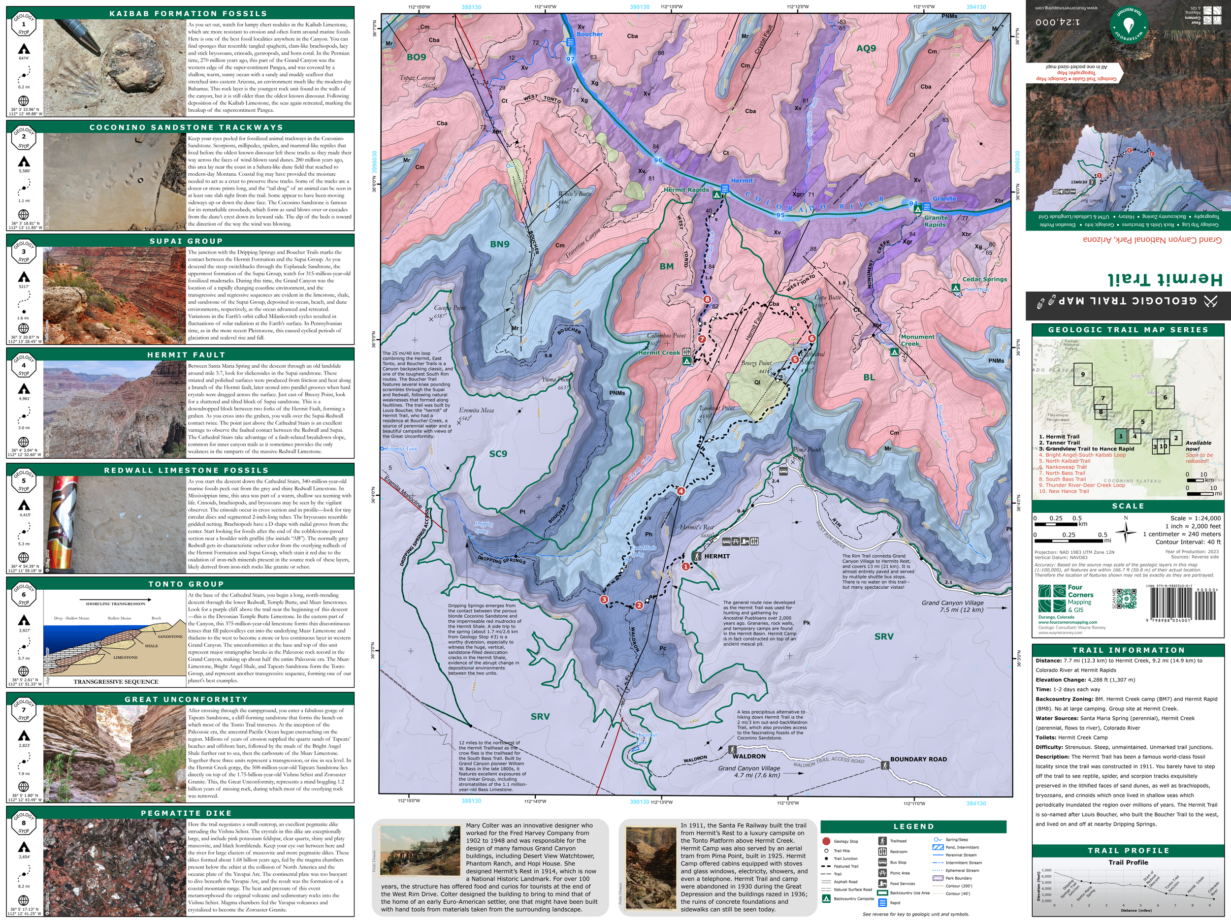
First Place, Student Cartography Contest, Mapping the Grand Canyon Conference, 2019: Geologic Trail Maps of the Grand Canyon
The Geologic Trail Maps of the Grand Canyon are folded, pocket-sized, waterproof and tear-resistant maps that combine the best of two worlds: geology and hiking. Part geologic guidebook, part topographic trail map, the rich geologic content provides a succinct geologic summary of the trail without the need to bring a heavy guidebook. These maps won First Place in the Cartography Contest at the 2019 Mapping Grand Canyon Conference. Four Corners designed and published this series of maps, which are carried in the Grand Canyon National Park South Rim Visitor Center Park Store, at area retailers, and are sold online. They are also available as GeoPDFs at AvenzaMaps.
-

First Place, Best Cartography, Maps and Apps Contest at the Arizona Geographic Information Council 2019 Symposium: Geologic Trail Maps of the Grand Canyon
The Geologic Trail Maps of the Grand Canyon are folded, pocket-sized, waterproof and tear-resistant maps that combine the best of two worlds: geology and hiking. Part geologic guidebook, part topographic trail map, the rich geologic content provides a succinct geologic summary of the trail without the need to bring a heavy guidebook. These maps won First Place in the Cartography Contest at the 2019 Mapping Grand Canyon Conference. Four Corners designed and published this series of maps, which are carried in the Grand Canyon National Park South Rim Visitor Center Park Store, at area retailers, and are sold online. They are also available as GeoPDFs at AvenzaMaps.
Contact me.
info@fourcornersmapping.com
(970) 903-8575
Durango, Colorado